Your Ground.
Your Map.
Your Advantage.

The first hunting GPS built for Australian conditions — hunting zones, land boundaries, slope angle and offline maps. Made for our terrain and our rules, not adapted from overseas.


Download on the App Store Get it on Google Play
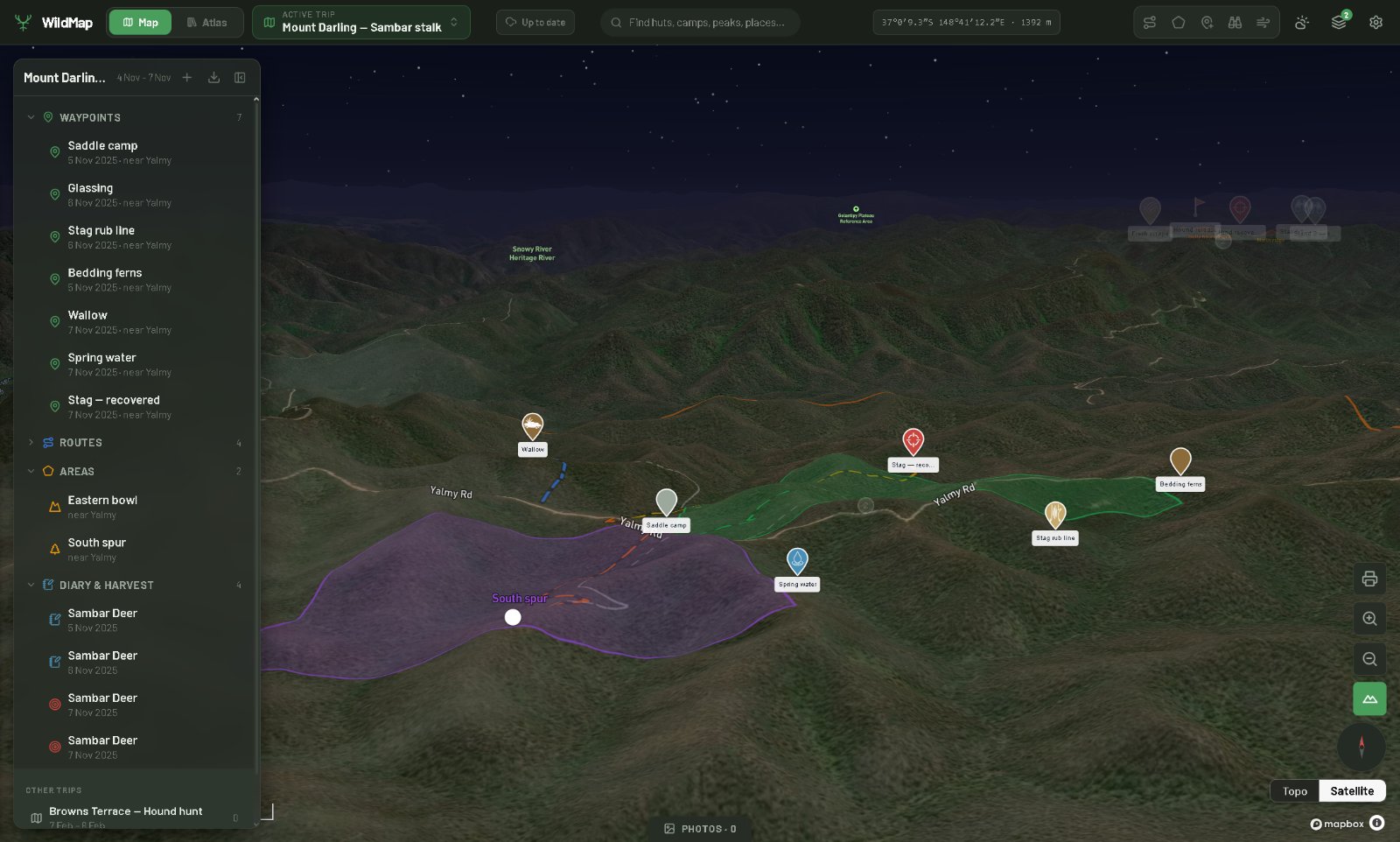
WildMap desktop planning view — 3D satellite terrain with waypoints, trip sidebar and hunting area overlays
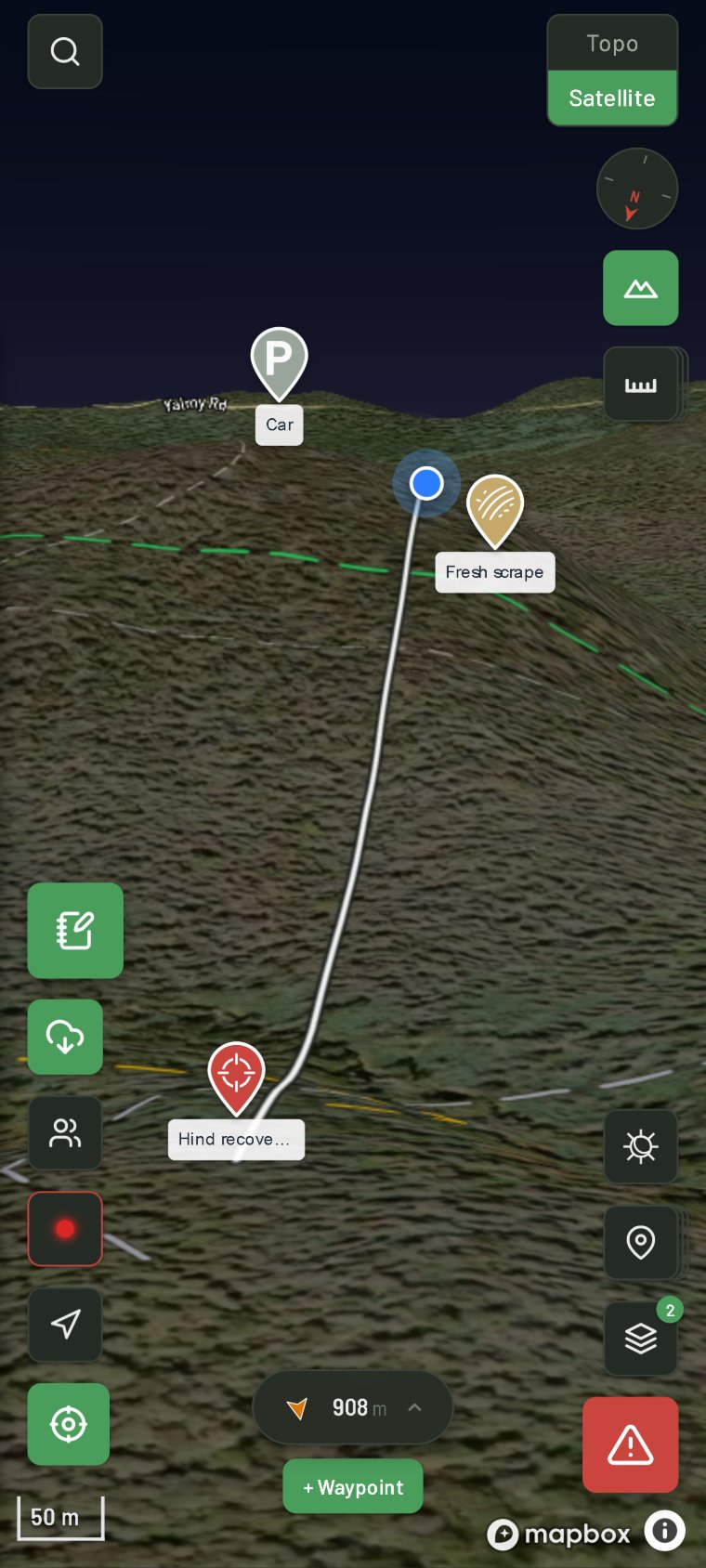
WildMap in the field — 3D satellite map with waypoints, navigation line and field controls
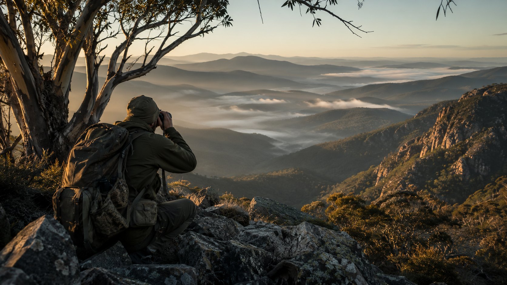
A hunter glassing across misty Australian high country at first light
Before dawn

Be ready before
first light.

Plan the ground, read the terrain and mark your line the night before — so when the light comes, you already know where to be. Reception or not.

Built for the way
Australians actually hunt.

In the app now

Every feature on this page is live today — built, tested and in the field this season. No roadmap. No "coming soon".

01 — Find your ground

Know where you can hunt.

Legal ground, private boundaries and a map that still works once the bars run out.

Hunting ZonesStandard

Official zone boundaries with plain-English conditions — what's open, dogs, and the licence you need.

Parcel InspectorStandard

See who owns the land you're standing on — name, lot/plan and exact hectares. Decide before you approach.

Offline MapsStandard

Download tiles before you leave reception. Map, GPS and waypoints keep working; changes sync on return.

02 — Read the country

See it before you're in it.

Terrain the way the deer use it — relief, aspect and the faces that hold sun and sign.

3D Terrain & Topo MapsFree

Satellite and topographic basemaps with full 3D relief — tilt to 60° and read the lay of the land.

Aspect & Slope ShadingStandard

Colour-shaded slope direction shows which faces catch morning sun and where deer bed down.

High-res Slope ShadingPremium

Finer 10m hillside contour detail in VIC & TAS — spot the ridgelines and gullies.

03 — Work the hunt

The tools you reach for.

Once you're out there: measure the shot, keep the party together, find the fresh ground.

Line of Sight & AreaStandard

Check the terrain blocking your view and read the straight-line distance, or draw a block to measure its area.

Live Party ModePremium

See your party on the map — last-known position, time and battery — to run a drive or regroup after a split.

Fire HistoryPremium

Recent fire-history boundaries across VIC, NSW & TAS — find the regrowth and green pick that pulls deer in.

Free — yours from download Standard — A$6.99/mo Premium — A$9.99/mo
See all 40 features40 toolsEvery tool in WildMap, grouped by category
Satellite and topographic map styles
3D terrain with pitch, tilt and elevation shading
Built-in compass with heading lock and range rings
Navigate-to waypoint with live bearing HUD
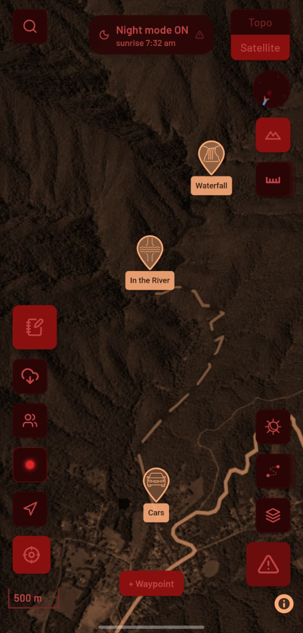
Night mode — deep red to protect low-light vision
Field mode — larger tap targets for outdoor use
GPS with accuracy circle and satellite count
Hunting zones for Sambar, Fallow, Hog Deer, Duck & Pest
One-tap zone conditions — access, dogs, licence
Victorian, NSW & Tasmanian cadastral boundaries
Land tenure colour-coding with ownership lookup
Slope angle overlay — 6-band colour shading
Elevation band filter — alpine, sambar country, lowlands
Historical fire ground by year across VIC, NSW & TAS
12 waypoint categories — wallow, kill site, camp, water
Attach multiple photos to any waypoint
Kill site harvest log with species, sex & weight
GPS track recording with pause and resume
Track stats — distance, elevation gain/loss, duration
GPX import & export — compatible with Garmin
Background tracking with screen locked
Line distance ruler with terrain-draped distance
Area tool — see hectares instantly
Line of sight tool using actual terrain elevation
Multi-point route builder with auto distance
Edit routes by dragging points — 50-step undo
Organise into trips with waypoints, tracks & notes
Right-click to drop waypoint or start tool (desktop)
Alpine huts with facilities and community photos
Camping grounds with amenity details
Alpine walking tracks layer
National firearms dealer directory with state filter
Search for huts, peaks, hunting areas and dealers
Submit missing campsites directly from the app
Sign in with email, Google or Apple ID
Cloud sync for waypoints, tracks, trips and notes
Works fully offline — queues and syncs on reconnect
All data persists across sessions
Share waypoints and tracks via link or share sheet
Collaborative trips with shared waypoints and pin chats

Introducing Night Mode.

The walk in is in the dark. The walk out is in the dark. So why does every other GPS blast your eyes with a white screen and wreck the night vision you spent 30 minutes earning? WildMap doesn't. Drag down the screen to see it.

WildMap satellite map in daylight
WildMap map in red night mode
Drag

The science of seeing in the dark

Your eyes take 20–30 minutes to adapt to the dark — the rod cells behind your night vision slowly flood with rhodopsin. One flash of white or blue light bleaches it and you're night-blind again. Deep red barely touches it, so your adaptation survives. It's why submarines, observatories and special forces all run red.

Every pixel: red channel only

Not a dark theme or a dimmer. WildMap rewrites every colour on the map — green and blue channels zeroed, only red left. Each pixel's brightness is set by true luminance and clamped so nothing glares. Labels drop away entirely.

#1a0000 #8a0000

On before you need it

WildMap reads your GPS and the sun, and can flip to red automatically in the 45 minutes before sunrise and after sunset — exactly when you're walking in or out. Three intensity levels, or leave it on auto.

The stuff you hope
you never need.

Hunting takes you off-grid, off-trail and out of reception. These are the features built for when something goes wrong.

Swipe through

Emergency Button

One press shows your exact position in decimal, DMS & UTM with one-tap copy, dials 000, and fires a pre-filled SMS with your coordinates and a map link. Bottom-right corner, always one tap away.

Navigate Back to Start

Lost the light or the track? Retrace your route with a live bearing and distance straight back to where you started — works with zero reception.

Premium

Live Party Mode

See your party's last-known position, time and battery — so no one gets left behind when you split up across country.

Fire Alerts

Auto-alerts when you're within 20km of an active fire. Live Victorian incidents refresh every 15 minutes.

Standard

Offline-first GPS

Your map, GPS and waypoints keep working with no reception. Everything queues and syncs when you're back in range.

Last Known Signal

Your last connected location is always saved, so if it comes to it, help knows where to start looking.

Dan has spent his life in the high country. Ian has spent his building software. WildMap is what happens when those two worlds meet.

D
Dan
Hunter

Owner and founder of Wild Deer magazine, with a lifetime in the Australian high country. Dan shapes the zones, layers and field logic — so what's on the map matches what's on the ground.

I
Ian
App Developer

The developer behind the app. Ian turns Dan's field knowledge into something fast, offline-ready and genuinely built for your pocket.

Nothing out there was made for the way we hunt here — Australian species, Australian terrain, Australian rules. So we made it ourselves, and it's still just the two of us, listening. Tell us what's missing and it tends to turn up in the next update. — Dan & Ian

4.2M+
Land parcels
mapped
277
Hunting zones with
season & access rules
7,800+
Huts & campsites
logged
10m
Terrain detail
slope & aspect

What hunters are saying.

★★★★★

This is a very impressive thing. You've got something amazing on your hands — very, very well done. I am yet to find anything it doesn't do.

Glen Coolahan
Sambar · VIC Alpine
★★★★★

While testing this app I used the distance tool, adjusted my scope and dropped the deer on the spot. That's about as good a testimonial as you'll get.

Michael Hogan
Fallow · VIC
★★★★★

Love the WildMap app. I've already got 20 hunters ready to download it. The cadastral layer alone is worth it — finally know what's public and what's not.

Adam Uytendaal
Fallow · TAS

7-day free trial.
Cancel anytime.

All plans include the full app. Billed through the App Store or Google Play — cancel any time before the trial ends and you won't be charged.

Standard
The solo hunter's toolkit
A$6.99/mo
or A$59.99/year — save 28%

  • Hunting zones for one state — VIC, NSW or TAS
  • New Zealand maps + hunting blocks
  • Parcel Inspector — owner, lot/plan, hectares
  • Slope-angle (30 m) + aspect shading
  • Night mode (red-light palette)
  • Offline maps + unlimited background GPS
  • Line-of-sight, area & snap-to-trails routing
Start free trial

7-day free trial · Cancel anytime

Most Popular
Premium
The full toolkit for serious hunters
A$9.99/mo
or A$89.99/year — save 25%

  • Everything in Standard
  • All 3 states' hunting zones at once
  • High-res 10 m slope shading (VIC & TAS)
  • Fire history — VIC, NSW & TAS
  • Live party mode — real-time mate locations
  • Trip sharing, collaboration & desktop planner
  • Photo cloud backup · new features first
Start free trial

7-day free trial · Cancel anytime

Early Access
Founder
Lock today's price for life
A$69.99/yr
Price locked for life — never increases

  • Full Premium feature set
  • Annual price locked forever
  • Only 500 will ever exist
  • No free trial — billing starts immediately
Claim Founder price

No trial · Price locked while continuously active

About the Founder price lock

The Founder Subscription is an annually recurring subscription billed at A$69.99/year — not a one-time or lifetime purchase. The price-lock applies for as long as your subscription remains continuously active. If you cancel or your subscription lapses for more than 30 days, the locked price cannot be reinstated. Only 500 Founder places will ever be issued — once they're gone, they're gone for good.

Get out there.
The map will handle the rest.

7-day free trial on Standard & Premium — cancel anytime before it ends and pay nothing. Available on iPhone, Android and desktop.

iOS & Android · Desktop at app.wildmap.com.au